
At the beginning of June, Julia and I travelled to Smolyan with our friends Nina and Yavor. We had planned several walks and photographic locations around the town, but the weather quickly became an important part of the journey. Heavy rain, low cloud and short periods of clear light repeatedly changed our plans. Smolyan lies in one of the highest parts of the Rhodopes, stretched along the narrow valley of the Cherna River and surrounded by coniferous forests, rocky ridges and mountain lakes. Many of the best-known places in the area are close to one another, yet they offer very different landscapes: open viewpoints above the valley, quiet paths through the forest, steep rock faces and rivers broken by dozens of waterfalls. During our stay, we learned to use the brief windows between the storms. We started before sunrise, returned when the rain became too heavy and went out again whenever the clouds began to lift. That rhythm gave us some of the strongest moments of the trip.
A Wooden Refuge between Smolyan and Pamporovo

We stayed at Villa Morava, set in the Karamanja area along the road between Smolyan and Pamporovo. The property is separated from the busier parts of the resort and consists of two wooden houses surrounded by open grass and forest. From the terraces, the view reaches towards Sokolitsa Peak, which remained visible above the greenery during our stay.

The houses are built largely from wood and have the warm, quiet atmosphere we wanted after the long days outside. There is also a sauna and an outdoor hot tub heated with wood, which made the place especially welcome when we returned wet and cold from the trails. Beside the main houses stands a modern interpretation of a hobbit house, adding an unusual detail without disturbing the natural character of the surroundings.
Sokolitsa was one of the places we had considered visiting, but the unstable weather did not allow us to include the climb in our plans. I was still able to photograph the peak with the drone, and its presence in the distance became part of the story of the villa. It was the place we looked towards each morning and the route we left for another journey.
The Rhodopes welcomed us with heavy rain. Any possibility of starting one of our planned walks disappeared, but the weather gave us time to settle in and enjoy the house. Later that evening, a close friend of mine from my university years, who now lives in Smolyan, came to see us. He suggested a lesser-known place for sunrise above the town and agreed to join us.
We arranged to meet at 5:30 the following morning at the parking area near the beginning of the Nevyastata eco-trail. The rain continued during the night, and we went to sleep without knowing whether there would be any sunrise at all.
Sunrise at Kaleto and Quiet Lakes after the Rain

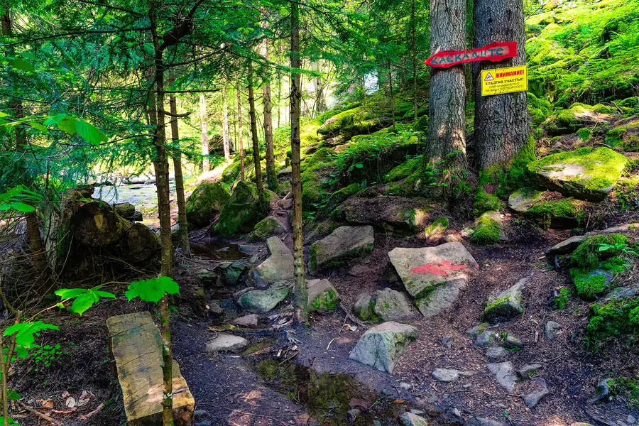
At 5:30 we met beside the arch of St Panteleimon Monastery, on the road between Smolyan and Pamporovo. Two paths begin behind the parking area. The better-known route turns right towards Nevyastata, while the trail on the left leads to the remains of Kaleto Fortress in the Turluka area.

The walk to Kaleto is only about 700 metres. The path passes through the forest and includes steps and railings along the steeper sections. After around fifteen minutes, we reached the open rocks above the town.
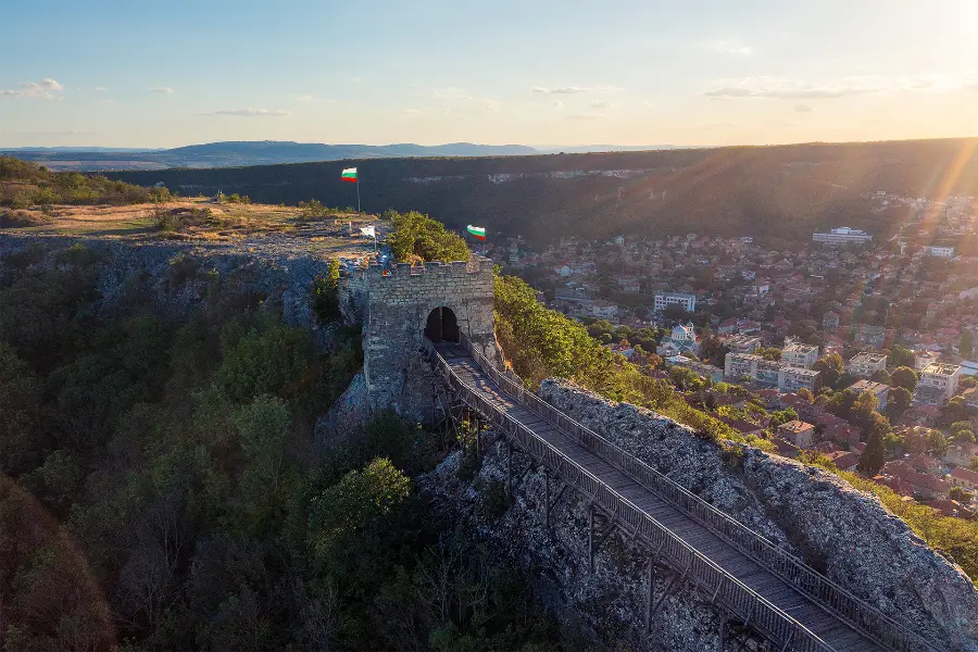
Kaleto dates from Late Antiquity and formed part of a wider defensive system across the Rhodopes. Its position allowed visual contact with other fortified sites in the mountains. Parts of the southern wall have been uncovered, but for us the strongest feature of the place was the view beyond the remains.
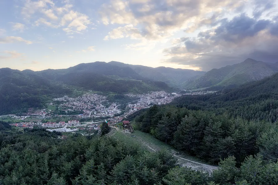
The rain from the previous day had filled the Smolyan Valley with low cloud. From above, the town was almost hidden beneath a broad layer of mist, while the higher ridges remained visible in the first light. As the sun rose, its rays slowly reached the forested slopes and began to separate the individual layers of the landscape.
The conditions were exactly what I hope to find when photographing a mountain sunrise. Instead of a clear and predictable view, the fog simplified the valley and left only the ridges, the warm sky and a few fragments of the town visible below. We remained on the rocks while the light changed and made a series of photographs before returning to the parking area.
We then followed the other path towards Nevyastata. The marked trail is about 750 metres long and normally takes around half an hour in one direction. It passes information boards, places to rest and two panoramic viewpoints. The route was busier and more developed than the path to Kaleto, but the views towards Smolyan and the surrounding rocks gave us another perspective on the same valley.
After the early start, we returned to the villa for coffee, rest and some time in the hot tub. The afternoon brought more rain, as almost every afternoon would during our stay. Shortly before sunset, however, the clouds lifted enough for us to visit the Smolyan Lakes.
The lakes lie in stages along the valley of the Cherna River beneath Snezhanka Peak and Orpheus Rocks. In the past there were around twenty, but today seven remain clearly formed, while others have become wetlands. After the rain, the water was quiet and dark, reflecting the clouded sky and the surrounding coniferous forest. We ended the day walking beside the lakes as the last light gradually disappeared.
Chervenata Skala and a Storm at Orpheus Rocks

The following morning we again left early, this time for Chervenata Skala. The forecast suggested that rain would return in the afternoon, so we needed to complete the walk and come back before the weather changed.

Chervenata Skala rises in the Golyamata Stena massif above the western part of Smolyan. The rock is a large rhyolite block more than one hundred metres high. Its name is usually connected with the reddish colour it takes on when the morning sun reaches its eastern face.
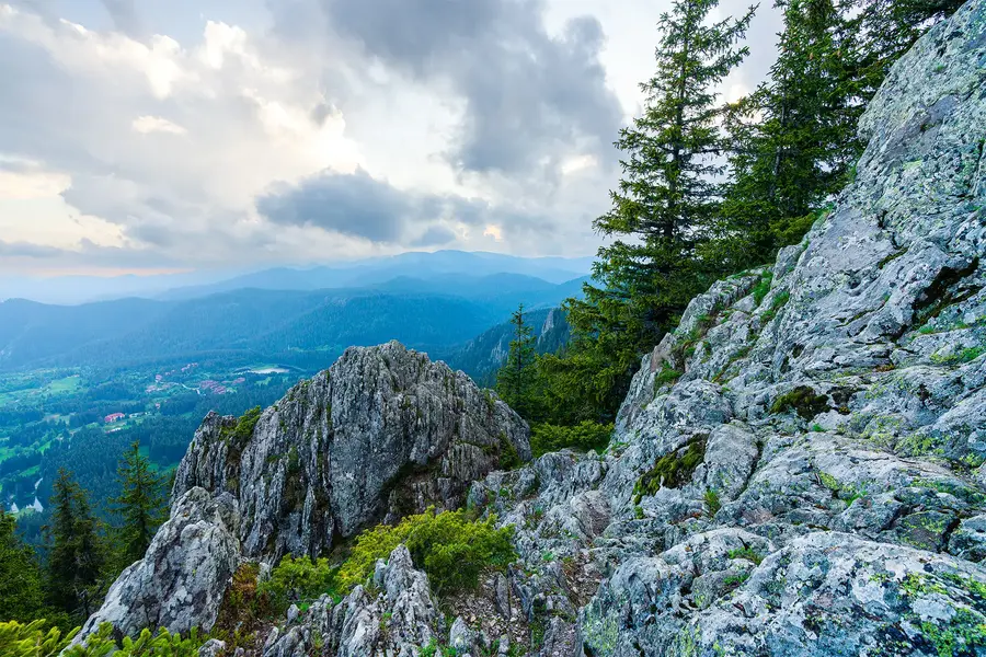
There are several possible approaches from Smolyan, the Smolyan Lakes and the area of the Canyon of Waterfalls. The officially described route from the town is approximately 2.6 kilometres and takes about two hours to climb. Most of the walk is considered moderate, but the final section below the viewpoint is considerably steeper and requires caution, especially after rain.
From the top, the view opens across Smolyan, the surrounding ridges and, to the north, Snezhanka Tower and Orpheus Rocks. The unstable forecast made us keep an eye on the clouds, but we were fortunate. We completed the route and returned before the afternoon rain began.
That evening we drove towards Snezhanka Peak to photograph the sunset from Orpheus Rocks. The trail begins from the saddle below the peak, beside the asphalt road leading towards the television tower. From there, a marked path crosses open meadows and reaches the rocks in about fifteen minutes of easy walking.
Orpheus Rocks stand at around 1,880 metres above sea level. The Smolyan Lakes can be seen far below, arranged along the valley between the forested slopes. When we arrived, the conditions appeared promising. There was still light beneath the clouds, and the open horizon looked suitable for a strong sunset.
We made several photographs, talked and waited for the light to develop. I decided to make a short exploratory drone flight. Only a few metres above me, the drone entered a cloud that had not been visible moments earlier.
When we looked around, we realised how quickly the mountain had changed. Clouds and fog were descending across the slopes, while a dark wall of rain approached from the distance. Then we heard thunder.
There was no reason to wait. We packed the equipment as quickly as possible and ran back towards the car. The sunset disappeared, but the sudden transformation of the landscape remained one of the clearest memories of the journey. Sometimes the strongest impression is not the light you expected to photograph, but the speed with which the mountain removes it.
The Canyon of Waterfalls and Last Light at Lagera

The next morning we again started early, hoping to stay ahead of the approaching rain. Our destination was the Canyon of Waterfalls, a route I had already walked twice. My previous visit had been five years earlier, so I was curious to see how the trail had changed.

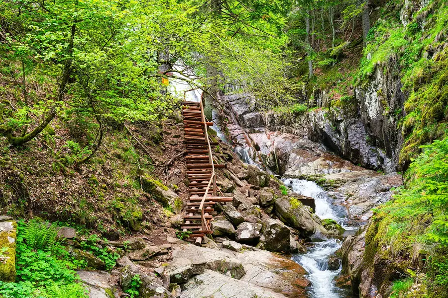
The eco-trail follows the Gerzovska River through the Soskowcheto Reserve and its buffer zone above Smolyan. The circular route is about 6.8 kilometres long and normally takes close to three hours without long stops. For photographers, however, the walk can easily take longer. The path repeatedly crosses the river on wooden bridges and climbs beside cascades, wet rocks and old coniferous forest.

Forty-six waterfalls are counted along the river. The largest is Orpheus, with a drop of almost seventy metres. Several smaller falls appear between the bridges, while the upper part of the route reaches panoramic platforms overlooking the canyon, the surrounding cliffs and Smolyan.
We had hoped that the spring water would still give the waterfalls a strong flow, and the conditions did not disappoint us. The forest smelled of wet leaves, the river was fast and the wooden structures disappeared into dense greenery. We had started before the path became busy, and for several hours we heard little beyond the water and our own steps.
This was my third visit, but the trail did not feel the same. Compared with five years earlier, I noticed considerable changes in the infrastructure and in the general maintenance of the route. On our way back, we met the person who was looking after the visitor centre and the trail at the time of our visit.
A maintenance fee was collected at the entrance. After seeing how much wooden infrastructure the route depends on, and how exposed it is to water, storms and winter damage, I considered the fee reasonable. Bridges, steps and railings in such terrain require constant attention, and during this visit the difference was visible.
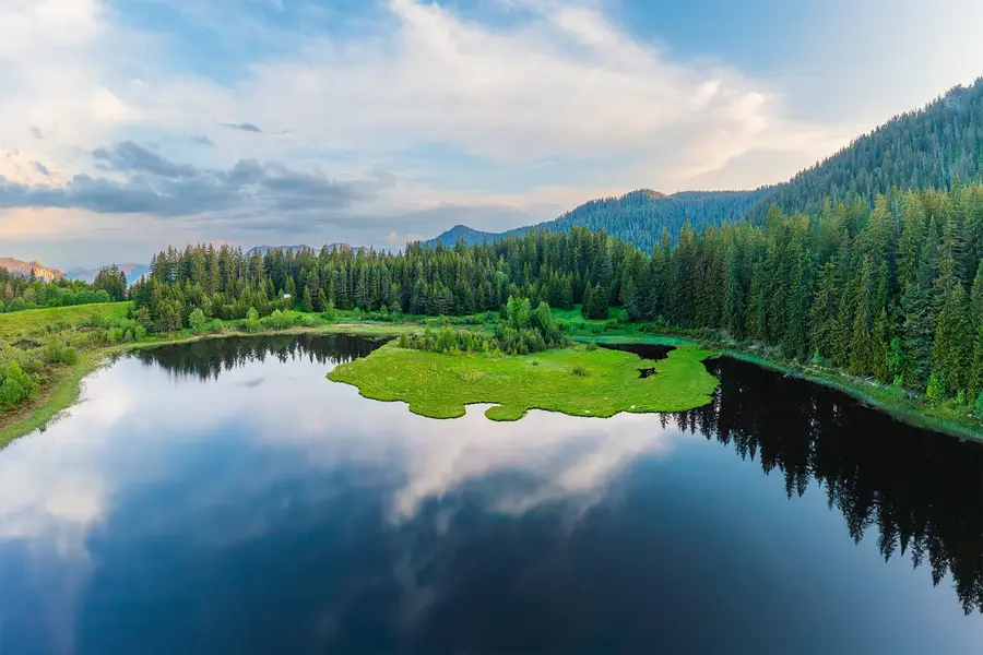
Later we chose a quieter place for sunset: Lagera Lake, situated near the better-known Smolyan Lakes but away from their most frequently visited path. Its dark, almost still water was surrounded by spruce forest and open green clearings. Patches of fresh vegetation broke through the surface and gave the irregular shoreline a distinctive shape.
As the sun lowered behind the ridge, long rays reached the water and the surrounding trees. I photographed the lake both from the shore and from the air, using the reflections, deep shadows and brief warm light to show the quiet character of the place.
We ended the evening at Bulgarche Restaurant in Smolyan. Its menu is centred on Bulgarian and Rhodope dishes, but what matters most to me is the quality of the food. Of the restaurants I have visited in Smolyan, Bulgarche remains first in my personal ranking.
The Museum of Magic and a Reason to Return
On the final day, we left Smolyan and stopped in the village of Momchilovtsi. There we visited the Museum of Magic, created by Bulgarian illusionist and actor Nencho Ilchev in his home village.
Before entering, I expected a small collection of stage props. Instead, we found a detailed history of Bulgarian illusionism and a large number of original objects connected with some of the country’s best-known performers. The exhibits include equipment and personal items belonging to artists such as Mister Senko, Fakira Miti, Astor, Orfi and many others who developed the art of illusion in Bulgaria during the twentieth century.
One of the most unusual exhibits is connected with Mister Senko and a Tesla coil made specially for his stage performance. Objects like this showed us that the history of Bulgarian magic reaches much farther back and contains far more technical invention than we had expected.
The collection is currently displayed in the restored building of the former monastic school in the centre of Momchilovtsi. The available space is not sufficient for all the exhibits, and a larger home for the museum is being prepared in another building in the village. Current plans include more exhibition space and a hall that can also host performances and festivals.
During our visit, the museum did not charge a fixed entrance fee and relied on donations from visitors. I found this both surprising and admirable. A collection of this scale requires conservation, space and constant work, so I would encourage anyone who visits to contribute according to their means.
The museum was a very different ending from the forests, lakes and waterfalls of the previous days, but it fitted naturally into the journey. The Rhodopes are not only a landscape. They also preserve personal stories, local memory and unexpected parts of Bulgarian cultural history.
When we finally left the region, I did not remember the trip as a sequence of failed plans caused by rain. The same weather had placed fog below Kaleto, left the forests fresh and green, filled the waterfalls and transformed Orpheus Rocks within minutes.
Sokolitsa remained on the horizon, still waiting for us. We did not see everything we had planned, but that did not make the journey incomplete. It simply left us with a clear reason to return to Smolyan and continue the story.